Input of Plan
For this type of assignment it is first necessary to "Load map" (1) - this can be e.g. a plan of the wall or just a map of the area where you want to build the wall.
After the substrate is loaded, the start (A) and end points of the wall (B) must be rectified. Place the map points (shown in red) at the required location on the map (either by dragging and dropping or by right-clicking) and then enter the real coordinates of points A and B (2).
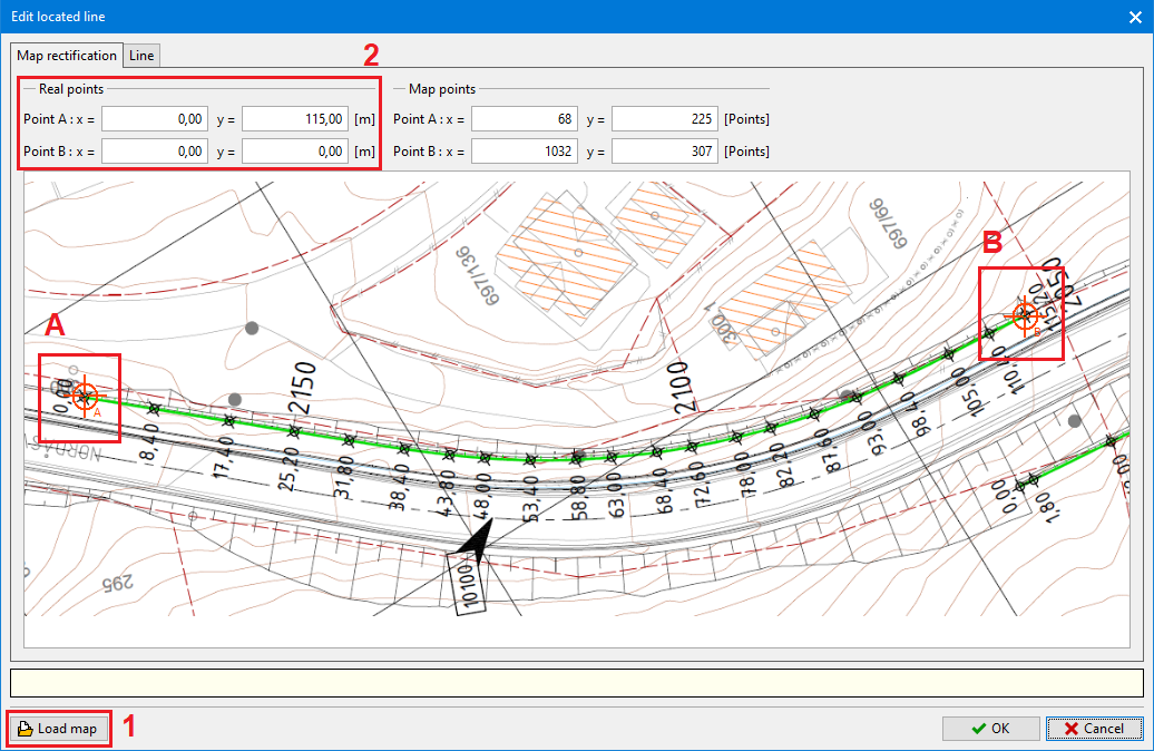 Input of plan - rectification of points
Next, switch to the " Line" tab, where you can create a plan line of the wall using points. The connection of the points is created by a curve of the "spline" type. The curve can be modified in various ways by stretching. For the points, it is necessary to define the heights of the bottom and top of the wall (sufficient for the start and end points). Press the "OK" button to transfer the coordinates and heights of the points back to the "Wall shape" frame.
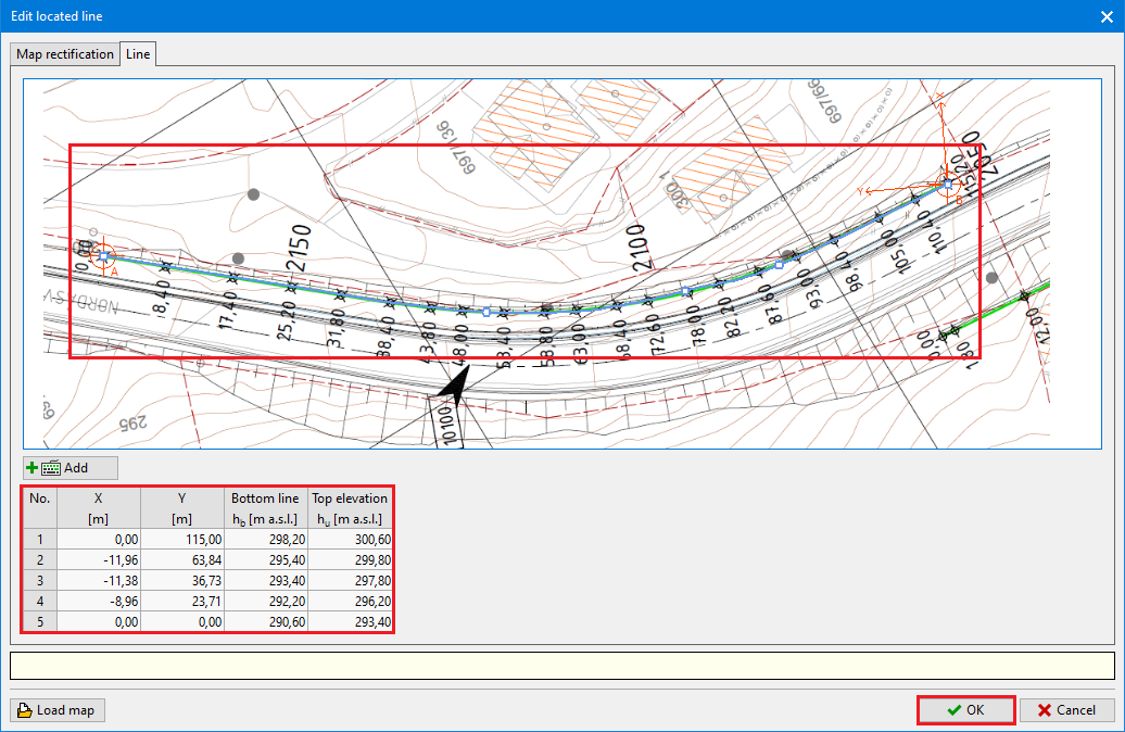 Input of plan - line input